
 Member
QShapes: a process modeling tool
A lot of time passed since my last post. As usually I’ve been too busy to keep the site updated, forgive me! Last time I let fall something about one of my university projects: qshapes. Now it’s time to tell you something more… QShapes is a process modeling tool, in short words a kind of 2D CAD.
I’m going to release it under GPL over berlios site. Actually I I’ve registered the project (see http://developer.berlios.de/projects/qshapes/ ), committed some code on the svn repository and uploaded some screenshot). The program is “quite” stable (there’re yet some crashes) and can run under linux, macos and windows. It’s written in C++ using Qt for the gui so it’s really portable. I think I’ll use this program as a starting point for one of my dreams: a multiplatform open-source diagram creation tool like dia, kivio or Microsoft visio®. I like dia and kivio but both lacks of some components / features. Since I don’t like too much “gnomish” software I’ll never improve dia. On the other hand kivio is quite pretty but poor than dia in some situations. Especially kivio isn’t multiplatform and this’s a great problem for a me.
But now I’m really busy so I’ll start working on this project after my second level thesis (I’ll tell you something about it really soon).

 schiele
Grouse Mountain
Yesterday I decided to hike Grouse Mountain in the evening. I set up my GPS receiver to head to Grouse Mountain. To see what happens when you select a destination that is not reachable by car I selected the peak. This was not a wise idea because where a car navigation system would have just said that this is not reachable my system with a full topographic card loaded just said: Well, if we can't reach it on public roads then let's continue on some trails and thus wanted to send me up the Old Grouse Mountain Highway. Unfortunately I didn't inspect this any further and started to move the car with the intention just to drive as long as it is possible and allowed to use the car. The result was that I didn't reach the Grouse Grind hiking trail and had to drive around half of the mountain again.
Finally I reached the right place a short time before the trail closed and I can say that the navigation system is really helpful if you have no clue about the street system of an area. The first thing I saw was a number of warning signs about the trail being dangerous and about a black bear in the area. I started going upwards. The first part was stressful but comfortable to walk. After some time of sweating I reached a point that claimed itself as being the 1/4 mark and informed that nobody will take any responsibility if you continue. And it mentioned that it will become steep now and one might consider to return. I continued and found again a sign warning of the black bear. Actually this sign was customizable for various sorts of bears. I climbed and climbed and I found what they meant with steep. There were some areas where it was more comfortable to make use of your hands while climbing. After about 75 minutes and 800 meters in height I reached the platform of the Skyride mountain station. The people there are really funny: They have placed a sign that the ground might be wet. I suppose if you manage to slip on their wet ground you shouldn't have climbed the trail at all.
From this point I could see the peak:

You could also see Vancouver:

And I finally found the bear!

Then I decided to go down again here:

Actually I used a cabin like this:

"Und wer hat's erfunden?"

Reaching the base again I found that the bear didn't take my car and I could drive home again.

SeaBus, North Vancouver, Lions' Gate Bridge, and Stanley Park
Yesterday evening I was using SeaBus to North Vancouver. Vancouver seen from there looks like this:
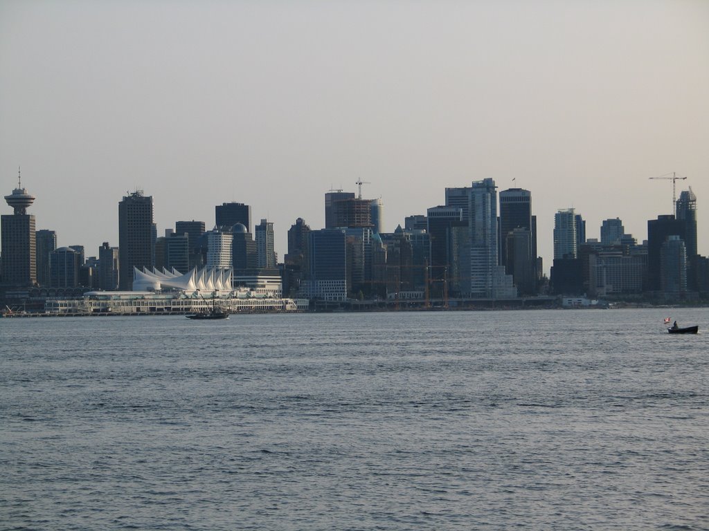
Having reached Lion's Gate Bridge after about 4km from the SeaBus terminal I was reaching Stanley Park:
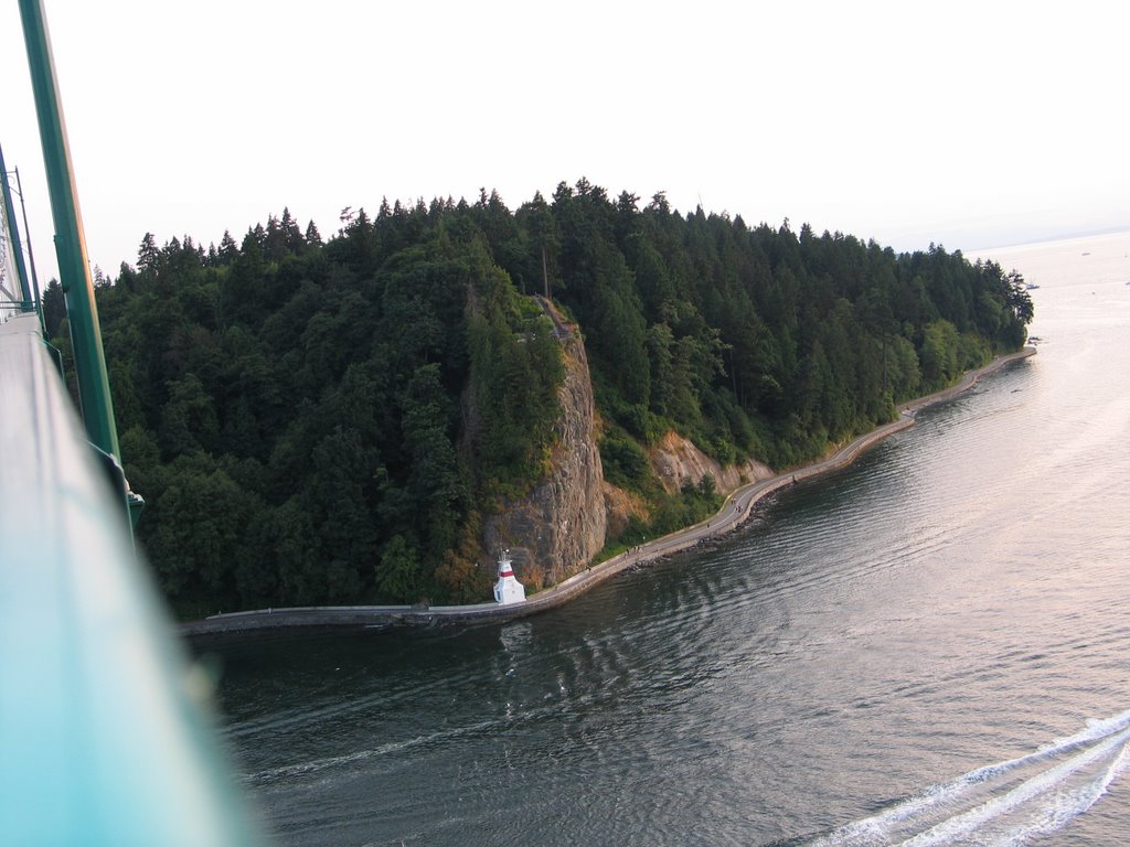
Unfortunately I decided for the wrong side to walk on the bridge thus this picture has too much bridge included in the spectacular view to Vancouver Downtown:

In Stanley Park there was someone else inspecting the area. But most likely he just inspected whether there are tourists to feed him.

Finally a look back to the bridge

I was walking some dark paths through the park back to Vancouver. The wood is really making everything dark there. In the evening you feel that sun has already set because it is so dark but when reaching an area with less trees you find that this is definitely not true.

First Vancouver report
Ok, since the first complaints arrived that there is nothing to read here I will start now with a first report. At Frankfurt Airport I was waiting until this airplane arrived to bring me to Toronto:

In Toronto there was a similar Airplane to bring me to Vancouver. But since this is getting boring now and there was no good place to make a nice picture of it anyway (it was blocked by all sorts of loading ramps and stuff like that) I decided to fly with it without taking a photo.
In Vancouver I took the bus to the house I am living for the next three weeks. No pictures yet because there should be something left in case days are getting boring. ;-)
The first day I was mostly organizing stuff, buying essential things, fetching my car from the car rental company and so on. To see as many places of the city as possible, I decided to walk all the way (with the exception of the car obviously).
I have seen many famous tourist attractions on my way but did not take any photos that day. You may look up these things in any tourist guide book. I can confirm that pictures there are appropriate. When trying to buy some electronic map data for my GPS receiver I failed to do so in any job in Downtown (the staff in some Canadian computer shops is as clueless as in many German computer shops). Finally I found a great equipment store in an industrial area east of Chinatown that had everything in store you could dream of if you do outdoor activities. The guy at the shop was extremely confused about how someone that never was there could find his shop at all.
Since the way I walked that day summed up to about 40km and I was a bit tired because of changing the time zone I decided to call it a day.
Today I started with running along the shore line to the English Bay Park. You can track these activities here.
Then I found something familiar to German people:

Must have been a spy because he was parking near operations center of one of his competitors:


Currently I am sitting here at the Vancouver Public Library to write all these stupid things:

Now I have to do some useful stuff again. Have fun!
Off to Vancouver

Fruity
I released Tangerine 0.2.6, which includes some minor bug fixes. Also now that SLED 10 is out, I can do a screencast showing Tangerine running under it. So I did, and you can see it here.
Update: It was suggested to me that a screenshot might be needed too, so here you go :)

The control panel for Tangerine
Spotlight
Thats the quick update on what I am currently into. Lets run through the various other things, quickly:
LDTP, my passion and a project headed by my buddy, Nagappan, received a Google SoC through GNOME and Prashanth Mohan is already knocking it out.
The SoC proposal consists of three milestones: LDTP integration with jhautobuild, Evolution automation and LDTP Regression suite and Prashanth has started working on the second milestone and tinderbox integration is on the final stages to get upstream. For those interested, the log of a real test, run on the test server provided by Frederic Peters is here and a detailed log is here.
Two students, sp2hari and taggy from NIT, Trichy, spent 6 weeks as intern, as part of NOSIP, work like mad and contributed an awesome tool for LDTP called Record. Record captures the user actions on any application and generates a LDTP test script that can be played back. This makes generating-test-scripts easier - simply, automated test-script generation.
Evolution
After a mammoth effort by the team and the community, Evolution 2.6 is stable and sleeker than its previous versions.
Recently, Phillip Vanhoof came up with the idea of mmap()'ing CamelFolderSummary instead of fread'ing it. We had around 2 hours of discussion and shared my experiences on CamelFolderSummary and other related things that he should consider when implementing mmap(). He has some 12 versions of patches and is close to what I asked for. Kudos!! Phillip.
However, the behaviour of the patch is yet to be analysed on various other scenarios: Couple of them are 1) When messages are deleted, 2) When message flags are changed.. etc.
Moreover, before taking upstream, the patch should be tested on a decent sample size using evolution and all the folder operations should be verified. Also, the patch should give a choice to the user/application to choose between mmap() and fread(). Guess, with said final touches it should make it upstream. Phillip? ;-)
That's all for now.. stay tuned!!

photos and cover art in ipod-sharp
I’ve been working on ipod-sharp recently to add cover art and photo support. It’s nearly complete now, and I can add and remove art and photos on my video iPod. Another person has tried it successfully on his Nano, so all that’s left to test is a regular iPod Photo. There might be some issues to work out yet with the camera adaptor too. A big thanks to Larry who did the initial work and provided the scary image conversion code :)
I’ve added cover art support to Dopi in svn. It uses Cover.jpg (or cover.jpg or folder.png, etc) if one is present next to the files when you add them. I suppose one of these days I should add a crappy “track properties” window so you can view/change the cover art there.
I’ve also created a patch for Banshee to make it use the new ipod-sharp and sync cover art. To try it you’ll need ipod-sharp and libipoddevice from svn/cvs.
Oh I also converted ipod-sharp to use gmcs. Hooray for generics.